From Street Rankings to Robotaxi: Spatial Intelligence Unlocks AutoNavi’s Full Imagination
AutoNavi & Xpeng Join Forces to Bring Spatial Intelligence to Robotaxi

A Teaser That Sparked Speculation
Earlier this week, a mysterious poster set the tech community abuzz:
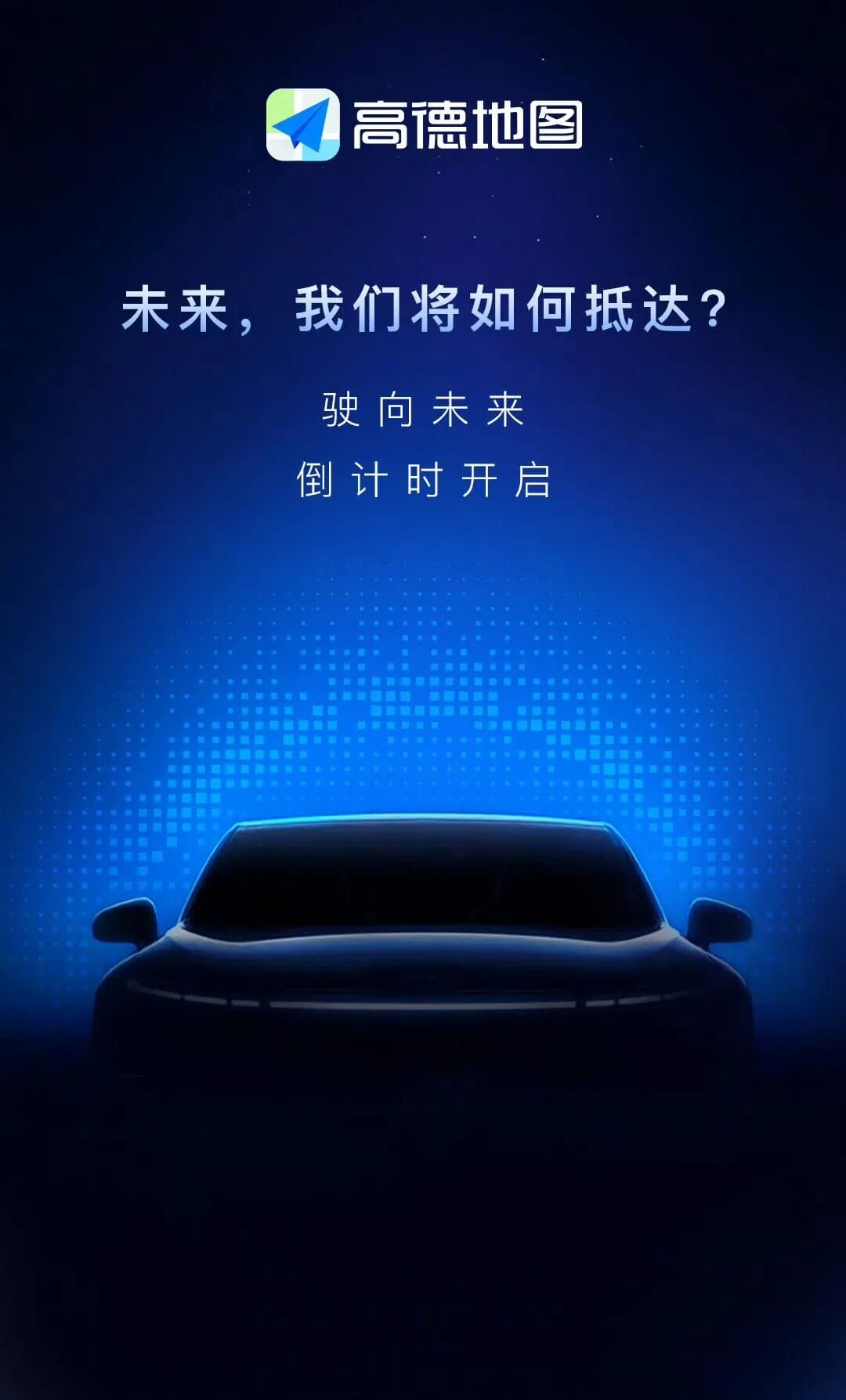
> “Is AutoNavi making a car?”
> “Is AutoNavi building a flying vehicle?”
> “Is AutoNavi launching its own autonomous driving or ADAS system?”
Social media quickly filled with guesses. These weren’t without reason — AutoNavi recently pivoted toward spatial intelligence, launching products like Teacher Gao and the [AutoNavi Street View Leaderboard]. The move signaled ambitions beyond traditional maps and navigation, leveraging decades of expertise in modeling the real-world’s physical complexity for broader scenarios.
Given the potential applications, “cars” seemed a logical first step.
---
Partnership Announcement
November 5th: AutoNavi revealed a partnership with Xpeng Motors, aiming to jointly provide Robotaxi services on a global scale.
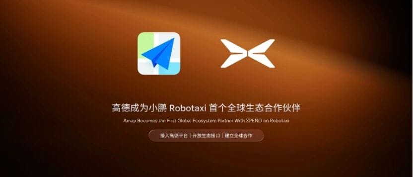
For AutoNavi, this marks a major milestone — integrating and opening up spatial intelligence within mobility services and transforming the concept into real-world deployments.
---
Embedding the “Spatial Brain” into the Physical World
Towards Artificial General Intelligence (AGI)
Why Spatial Intelligence Matters
The AI community often debates what kind of intelligence is truly useful and most likely to lead to AGI. Key concepts arise:
- Full context awareness
- Active interaction with the environment
- Closed-loop performance tied to real-world scenarios
Language models like GPT or Claude offer smooth conversations, but without explicit human-provided inputs, they lack awareness of here-and-now — location, time, surroundings, or upcoming events.
Limitations of Current AI
Language-space intelligence misses core capabilities:
- Spatial awareness – understanding place and time context
- Temporal prediction – reasoning about what’s likely next
- Physical interaction – learning by engaging with the world
These are fundamental for biological intelligence:
> “Where am I? How is my environment changing? What can I do?”
Action then leads to feedback and adaptation.
AutoNavi’s Spatial Intelligence in Action
- Travel planning: While GPT can suggest itineraries, AutoNavi calculates real travel times, compares costs, matches schedules to venue hours, and finds optimal accommodations.
- Driving safety: GPT can explain emergency procedures; AutoNavi can actively alert drivers about accidents or closures kilometers ahead.
This defines two modes of intelligence:
- Static & reactive (language models)
- Dynamic & proactive (spatial models)
AutoNavi’s advantage lies in its predict–act–verify loop, continuously refining models through live spatiotemporal data — a challenge for pure language AI.

---
Robotaxi Meets Spatial Intelligence
A Transformation in Motion
Current State of Robotaxi
Robotaxis have progressed in vehicle-level intelligence, yet local sensing alone struggles with city-wide, complex traffic dynamics — e.g., accidents or temporary closures.
Spatial Intelligence Enhancement
By integrating city-scale, real-time environmental data, fleets can:
- React proactively to disruptions
- Optimize routes dynamically
- Coordinate across multiple vehicles
---
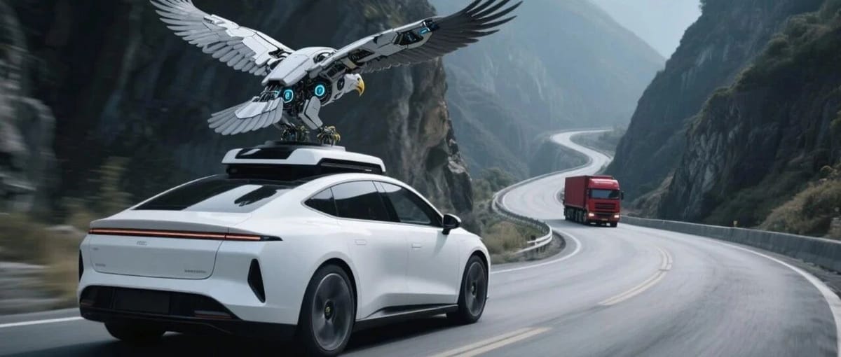
AutoNavi’s “Beyond Visual Range” Capabilities
Powered by TrafficVLM
- Acts like “eagle eyes” for traffic
- Detects incidents kilometers ahead via twin traffic simulation systems
- Predicts congestion spread and issues early warnings
- Example alert:
- > “Accident ahead within 3 km. Many vehicles merging right. Please move right early and yield to emergency services.”
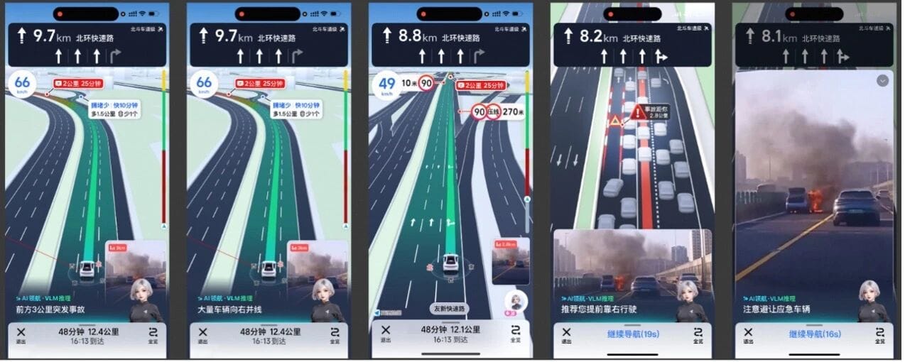
Cloud Dispatch System
- Instantly responds to congestion
- Retrieves real-time visual data from the scene
- Uses depth analysis to reconstruct traffic layouts far away
---
AutoNavi’s Data Strength
20+ years of:
- Tens of trillions of spatiotemporal samples
- Multi-channel data fusion:
- Spatiotemporal modeling
- Visual monitoring
- Official data feeds
- User contributions
This context enables anticipation and action, boosting Robotaxi safety.
CEO Guo Ning: AutoNavi delivers a stable, shared spatial intelligence infrastructure, lowering industry barriers. Manufacturers can focus on vehicle innovation while relying on AutoNavi for complex spatiotemporal understanding.
---
Beyond Robotaxi: Wider Applications
Consumer Features
- Teacher Gao: 2.6 billion invocations in one day during National Day holiday
- Street Rankings: 400M users in 23 days
Example benefits:
- Personalized travel decisions from location and behavior data
- Authentic business rankings from multi-dimensional analysis
B2B Impact
- Smart Wearables: Partnering with Thunderbird to deliver real-time geo info and navigation via smart glasses
- Aerial AutoNavi: Building an open platform for the low-altitude economy
---
A New Paradigm
Spatial intelligence is emerging as the spatiotemporal foundation for multiple industries — from urban mobility to retail, from personal assistants to industrial applications.
> The past 20 years made information instantly accessible;
> The next 20 could make the physical world computable and predictable.
When AI masters time and space, it evolves from answering questions to sensing, forecasting, and deciding.
AutoNavi is poised at this critical juncture.
---
Related: AI Content Monetization
AiToEarn — an open-source AI content monetization platform — shows how intelligent infrastructure can empower creation.
Features:
- AI-powered multi-platform content generation & publishing
- Supports Douyin, Kwai, WeChat, Bilibili, Rednote, Facebook, Instagram, LinkedIn, Threads, YouTube, Pinterest, X (Twitter)
- Integrates analytics & AI model rankings
---
© THE END